3 min read
Becoming a Trusted Advisor in Catastrophe-Prone Areas: A Guide for Insurance Agents
I recently had the opportunity to present to several dozen agents for the PIA Western Alliance last week. The title of my presentation was: ”Wildfire...
3 min read
Nicholas Lamparelli
:
Apr 30, 2026 10:12:57 AM
For years, "digital twin" was a phrase that lived comfortably in conference keynotes and vendor pitch decks. It sounded futuristic and vaguely useful. That phase is over. Several carriers and MGAs are now running production workflows against persistent, continuously updated digital representations of insured properties. If you haven't encountered one of these systems yet, you probably will within the next renewal cycle.
Strip away the buzzword and you get a structured data object tied to a specific property that aggregates and reconciles multiple data feeds: aerial imagery, parcel records, permit history, building footprint geometry, roof condition scores, wildfire and flood exposure layers, and sometimes IoT sensor data. The twin persists across time, so you can see how a property's risk profile has changed, not just what it looks like today.
The key difference from traditional property prefill is that a digital twin is longitudinal and relational. It connects the roof replacement permit from 2021 to the aerial imagery from 2023 to the updated replacement cost estimate. Prefill gives you a snapshot. A twin gives you a timeline with context.
The obvious application is property underwriting, and the gains are real but specific. A digital twin lets an underwriter (or an automated underwriting rule) compare the current state of a property against its state at last binding. Did the insured add a detached structure? Has vegetation encroachment increased wildfire exposure? Is the roof condition score deteriorating faster than expected for its age and material?
This changes renewal underwriting from a largely static exercise into something more like continuous monitoring. Carriers running these systems report catching mid-term exposure changes that previously slipped through until a claim surfaced them. Think unpermitted additions, new trampolines or pools, or tree canopy growth pushing a property into a higher wildfire tier.
On the claims side, a pre-loss digital twin gives adjusters a baseline. After a cat event, comparing the twin's pre-event state to post-event imagery accelerates damage assessment and reduces disputes over pre-existing conditions. Some carriers are using twins to pre-stage reserves on properties in the path of a named storm before the first notice of loss arrives.
Portfolio managers get a different benefit: aggregation views built from individual twins. Instead of relying on modeled exposures based on construction class and ZIP code, you can build a bottom-up view of actual roof conditions, actual defensive space, actual building characteristics across a book. That feeds directly into reinsurance submissions and treaty negotiations with better data than most ceding companies currently provide.
Digital twins are data-hungry, and data quality is uneven. Aerial imagery refresh rates vary by geography. Permit records are a mess in most jurisdictions. Reconciling conflicting data sources (the county says 1,800 square feet, the MLS says 2,100, the aerial footprint suggests 2,300) requires rules and confidence scoring that are still maturing. If your twin is wrong about the property, it's worse than having no twin at all because it creates false confidence.
There are also regulatory questions. If you have a continuously updated risk profile and you don't act on it, does that create E&O exposure? If you non-renew based on aerial imagery the insured has never seen, how does that play in a market conduct exam? These are live questions without settled answers.
For more on how digital twins are entering production workflows at carriers, read the original piece at Property Intelligence Report.
If this kind of analysis is useful to you, subscribe to InsNerds for more coverage of the tools and data strategies reshaping insurance operations.
3 min read
I recently had the opportunity to present to several dozen agents for the PIA Western Alliance last week. The title of my presentation was: ”Wildfire...
3 min read
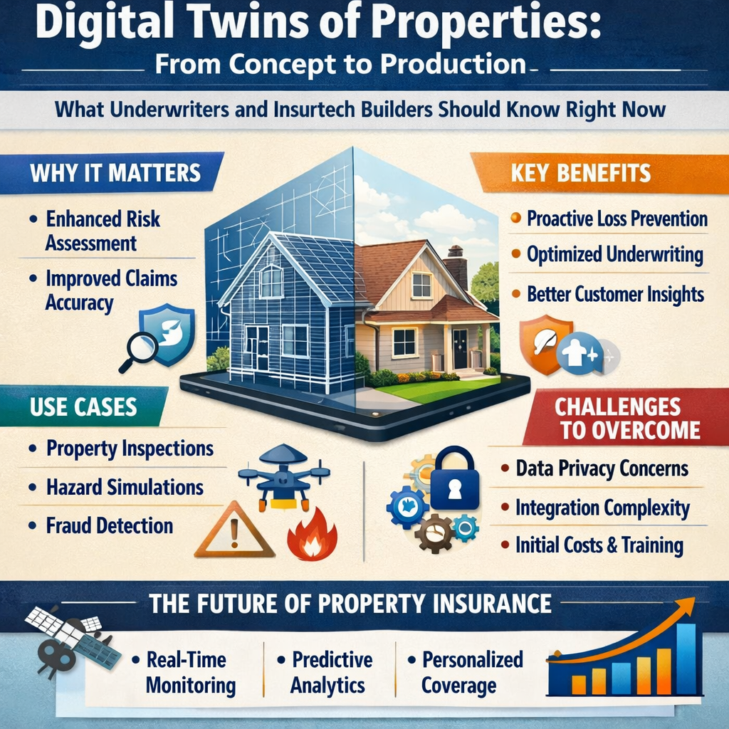
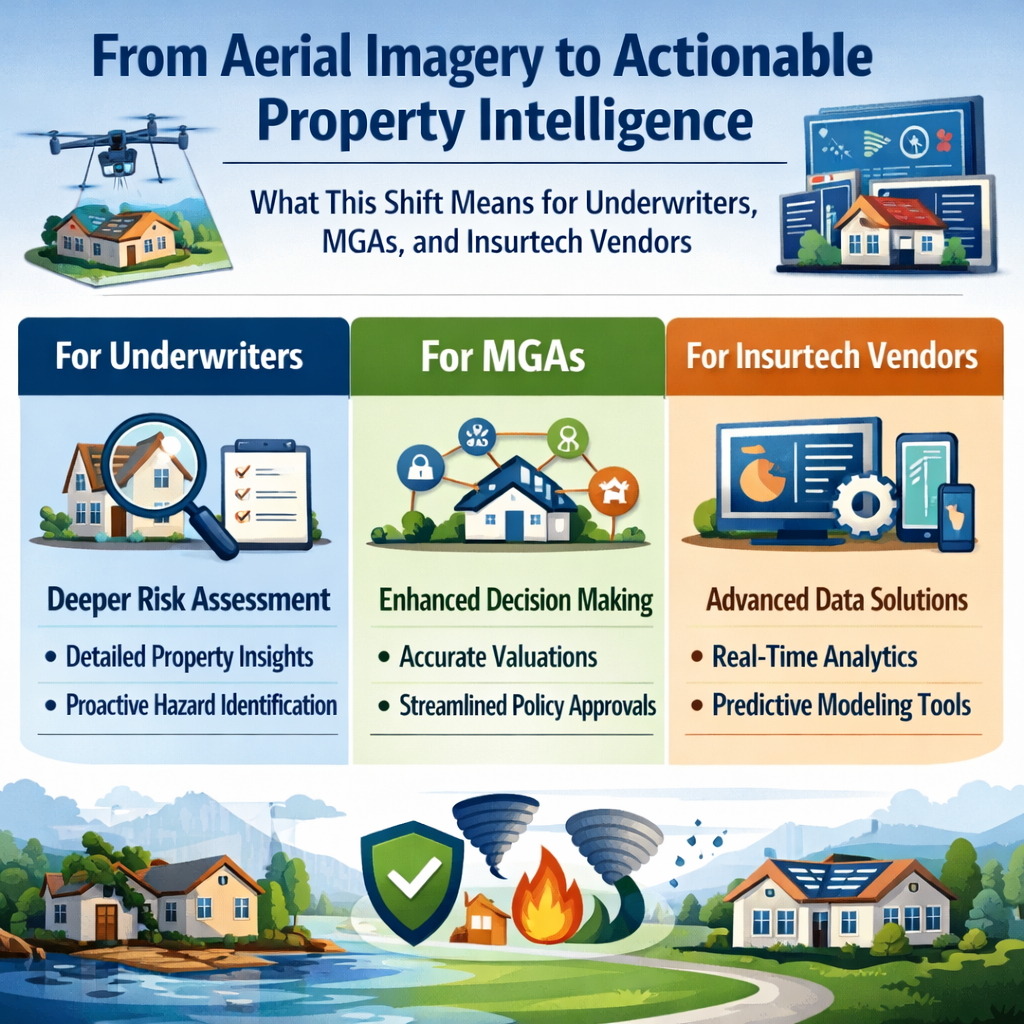
The market for geospatial property data is shifting from raw imagery to pre-digested, decision-ready analytics, and the implications ripple across...
2 min read
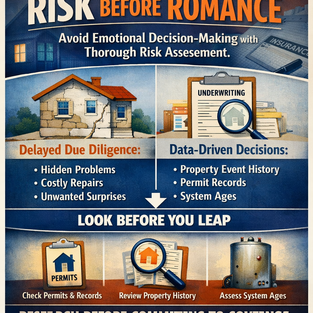
A PropertyLens article exploring homebuyer decision-making reveals a principle that resonates directly with insurance professionals: thorough risk...